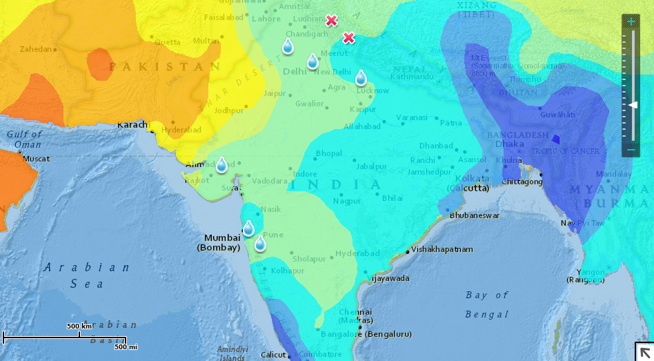
This is a map about monsoons in India. This map is showing the rainfall totals in India. The darker the blue, the more annual rain fall the areas of India receive. next are the symbols I put in. The water marks the places with the most flooding, causing deaths. The Xs represent the places with the highest death totals. Based on the map, we can tell that the north-eastern areas receive the most rain fall, and as a result, the north has the highest death totals, as well as more flooding, causing more deaths. However, looking to the west, there are tons of floods even though the rainfall is very little. This is most likely due to being by the ocean and the fact that it is very dry just to the north in Pakistan.
